
There is so much public land in California that you can be remiss in remembering that there is a lot of private land abutting the public ones. I have only run into this twice before in my travels around SoCal. Once there was a peak I couldn't summit and once there was a distinct lack of friendliness due to posted signs along the road to the Cleveland National Forest. My attempt at the summit of Oat Mountain was thwarted by this private/public divide but I still had a good time.
It was my understanding that after exiting the 118 freeway, I drive a few miles on a canyon road and come to a parking lot and start the trek. However, there were signs everywhere about half way through the canyon drive that it was a "private road" and that "gates could be closed at any time" and as I hemmed and hawed about it and drove a ways further on the road, there were more "private property" signs on the road so I turned around and parked at a clearly marked parking area for the Santa Monica Mountains Conservancy. I did speak to a ranger who indicated I could drive all the way on the road up to the parking lot so for anyone doing this mountain, keep going!
The downside of this strategy is that it added 2+ miles each way plus about another 500 feet of elevation gain on top of the 1,800 I was facing. By the time I got to my turnaround time on the trail, I was still about halfway up the mountain so I decided to turnaround thus "failing" to gain the summit but I felt good about the decision and I got some great pics so come with me, won't you, as I hike the trails around Oat Mountain.
The trail from the road starts off on pavement.

A lot of people bag on this hike because the trail is paved almost all the way up Oat Mountain but the elevation gain is no joke and the country is so picturesque that you forgive the pavement, wherever you find it.
The trail quickly gains a couple of hundred feet to a ridge line which you follow for 2 miles.

Along the way you get treated to cool rock formations

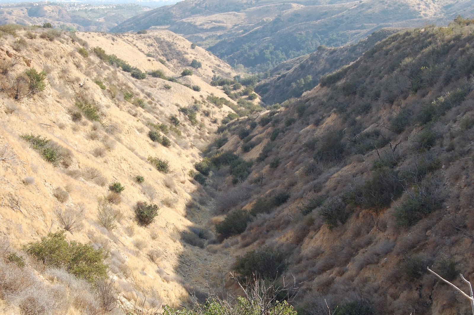
Beautiful rolling hillsides and mountains

And plenty of canyons.
I eventually made my way up the Oat Mountain motorway which contains numerous helipads. There was a helicopter practicing lands and taking off(s) I am just glad he didn't land on me as I was resting at one of the helipads!

Despite me not making the summit, the day was not a loss, there was beautiful air in the hills of Simi Valley today (an underrated hiking destination here in SoCal) and the views were spectacular. Some of my favorite shots in recent months came from today's hike and you best believe I am going to knock out this summit in short order over the next few weeks!
My Favorites:


If you want a more "in depth" trip report, check out Nobody Hikes In LA: http://nobodyhikesinla.com/2013/08/13/oat-mountain/


Nice pictures! I like the first one in your favorites!
ReplyDeleteThanks Josh, the colors really popped on that one after I got it home! I thought the middle one would come out better than it did and while I love all of my "children" the last one is really my fav. Glad you liked!
ReplyDelete