Tuesday, June 4, 2013
Hiking Box Springs Mountain
June 1st is National Trails Day, a day to go out and celebrate trails and perhaps help out with their maintenance. That may just be the most boring opening sentence ever written here on EWH but spurred on by this national call to arms coupled with my impending birthday the next day, I decided to strike out and hike Box Springs Mountain in Moreno Valley.
How did I find this place? Well when I was recently flying back to LA, I saw this mountain park show up on the GPS display and I was intrigued.
The hike reminded me a lot of hiking in Simi Valley, lots of swale grass
and rocks
What is really confusing about hiking here is about what is the "correct" trail and what is the "cut through" trail. You gain a LOT of elevation getting to the summit and the trailmakers put in a lot of switchbacks and then humans put in cut-throughs bisecting the switchbacks which is usually a big no-no.
In this case, its not clear which is which although the general rule of thumb seemed to be if you were going much more vertical than usual, you were on a cut-through.
(which is the right way?)
I usually slag the mad designers of switchbacks on these pages but today I was blessing them as the grade on the switchbacks was significantly less than the cut-through trails. Of course you have to hike more feet looping back and forth rather than going straight up which was an issue since it was H-O-T on the trail today and there is very little shade. I highly suggest hiking this mountain in the winter time, or when its raining/snowing, otherwise bring lots of water with ya.
There is no way around it, the heat was kicking my butt today on this trail but eventually you will make it to the summits
which have all been claimed by radio/tv towers.
If you are feeling up to it, you can amble along the fireroad that runs parallel to the tower complex
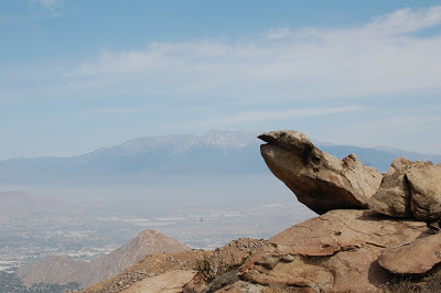
eventually ending up on a nice little "nub" (technical hiking term) that gives you great views of the surrounding mountains.
Overall I am glad my planes GPS steered my eyes towards this park. I just wish I did this one on November 1st rather than June 1st. How about we petition National Trails Day to be moved back a few months ;)?
Here is the map but a word of warning the trails aren't signed and with all the switchbacks/cut-throughs there is not guarantee you will be on the right trail so use common sense/compass rather than relying on this bad boy: http://www.rivcoparks.org/wp-content/uploads/BoxSpringsTrailMap.jpg
Subscribe to:
Post Comments (Atom)


0 comments:
Post a Comment