

Bass Lake also offers numerous hiking opportunities and I decided to take advantage of hiking Goat Mountain (the tallest peak in those parts).

Now, after spending a few days in Yosemite, Goat Mountain wasn't quite the same but it was interesting to see the differences in trails and environment from my Yose jaunt. I won't make you guess, the difference is primarily pine.


Lots and lots of pine trees. This hike has a significant elevation gain (or at least it felt like a significant gain) but you don't have many vista rewards along the way for your efforts due to all the pine trees. I was hiking toward a fire tower, which seemed to be the only thing above the tree line. There were cool views if you looked down to these little flowers.


I also never hiked a trail that is partially maintained by laying down rocks in worn away sections, truly a first.

Eventually you make your way to a junction of another trail that was used by several mountain bikers. Some jerk made this left pointing arrow on the trail. Why was this a jerk move?

Having never been on the trail but knowing the only thing people could possibly be going to up there for was the fire tower, I decided to turn left. Big Mistake! The trail started uphill (good sign) but then started going downhill and further downhill (bad sign). Definitely not in the direction of the FT (which is to the right). There were some cool red trees though (neutral sign?).


I had a particular turnaround time this day and it was fast approaching. Still, I backtracked to the intersection and gave it a go to the right get as far as I could towards the fire tower.
As you make your way further up the trail, it does start to open up "a little". Suddenly, you remember that you ARE hiking near Yosemite with that beautiful granite rock and big sky.


Eventually you do get to the intersection of the main fire road which leads to the fire tower.

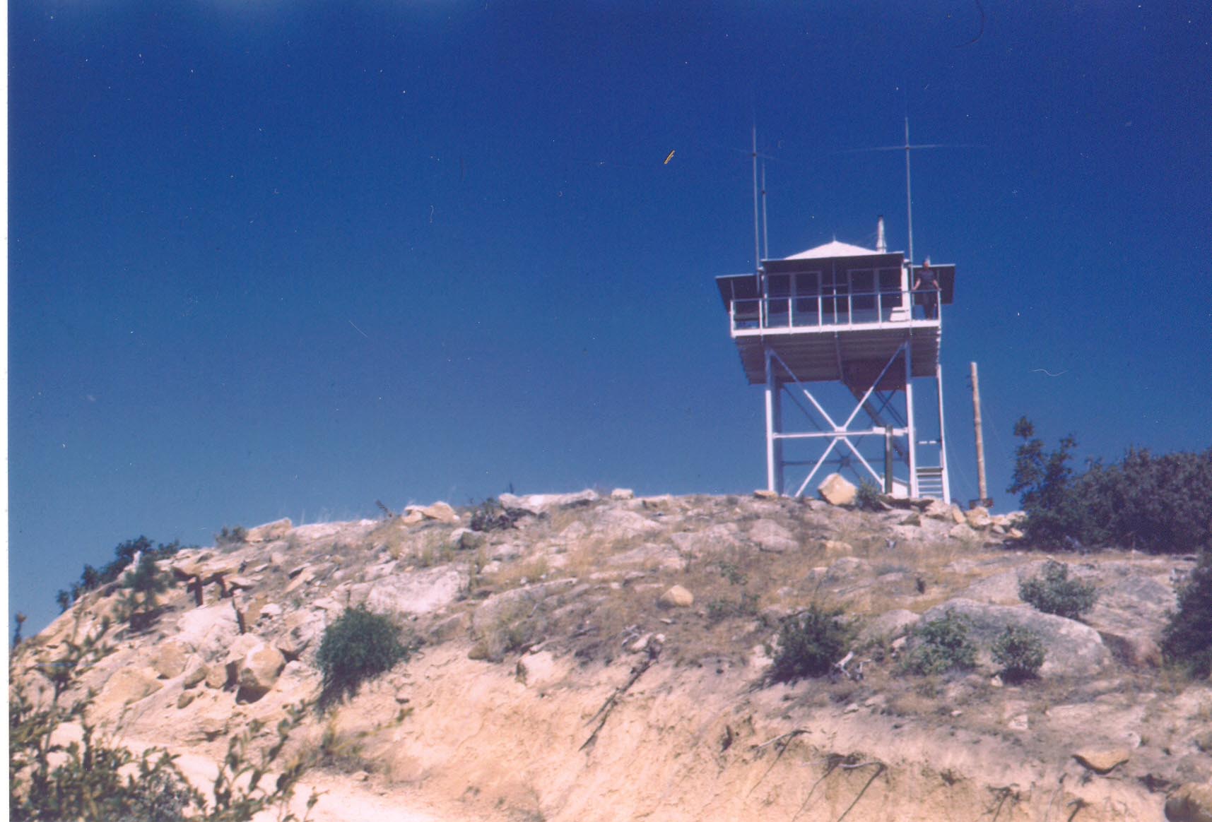
By that point I had to turn around so I have no pictures of this stupid frickin fire tower but I was fine with that decision. The hike was strenuous with its steady drumbeat of "uphill" but its not too bad and being around all that pine made up for not seeing the fire tower (or maybe I just really like pine). If you really want to see what all the fire tower fuss is about, check this out.

By that point I had to turn around so I have no pictures of this stupid frickin fire tower but I was fine with that decision. The hike was strenuous with its steady drumbeat of "uphill" but its not too bad and being around all that pine made up for not seeing the fire tower (or maybe I just really like pine). If you really want to see what all the fire tower fuss is about, check this out.
To give myself some trail karma, when I got back to the intersection, I pointed the arrow to the right and spelled out in twigs that the FT (fire tower) is thattaway.

Overall, this hike was a bit of a bust that was due partly because of my ignorance and partly because of the non-intuitive trail. That being said, if you have a few hours to hike this, you should do it, I bet the views are amazing. :P
This hike is accessed in the Forks Campground off of Road 222 in Bass Lake. The trailhead is by the dumpster on the upper road of the campground (there are only 2 roads in the small campground, when in doubt, go up and dumpster it).


0 comments:
Post a Comment