Tuesday, May 22, 2012
Hiking Azusa Peak/Glendale Peak
There are numerous "quintessential" hikes here in Southern California. Little guy hikes that seemingly everyone has gone on, like Eaton Canyon, Runyon Canyon, Topanga, etc. I just found out recently about another one of these hikes, Azusa Peak, so I decided to check the trail out.
First things first, this hike was brutal. The brutality was exacerbated by my sinus infection and a slightly wonky knee. Even without these ailments/excuses, this little hike has a BIG elevation gain (over 1,000 feet in about 1.2 miles) which will make you kiss the ridgeline once you gain it.
You have to get to the trailhead first which is accessed on the side of a fire station on the Glendora/Azusa border.
The Garcia Trail then switchbacks its way up a small sidehill/slash/flower garden which makes for a nice start to this puppy.
The trail is a worn singletrack that makes it way up switchbacks and the hillsides. Often you have to step aside to let people go past but otherwise the trail is in fine shape and there is definitely signs of maintenance work in the near past.
Eventually you start making headway which becomes apparent as you start getting closer to the "A" on the hillside.
While the A is not your ultimate goal, it is nice to see the tops of some mountains as you are struggling up the hill.
Also, this is a VERY popular hike. Many people seem to hike this trail early in the morning, since I encountered a lot of people hiking down the mountain. There was another wave coming up when I was on my way down so be prepared for a continuous stream of people.
Additionally, while there are splotches of shade on the trail, in reality, it is just you and the sun, becoming one. This holds true on the ridgeline as well (otherwise known as the Glendora Motorway), there are pockets of shade but bring the sunscreen.
Eventually, I promise, the ridge is gained!!!
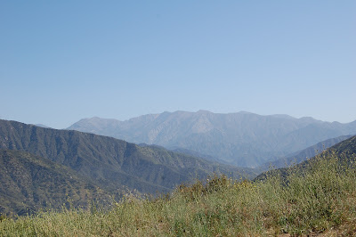
And as you can see, beautiful vistas of the San Gabriel backcountry come into view. Turning to the right/East, most people saunter up another 0.2 miles to the summit of Azusa Peak. You can tell you are there when you see this:
There is a nice little (and welcomed) bench up there to take in the sight of the hazy valley below. Most people will head back down the trail after gaining the summit but my attentions were drawn to Glendora Peak in the distance.
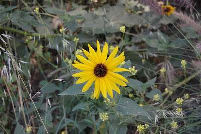
Glendora Peak is not necessarily the name of the peak as it seems to be unnamed but I have heard that name kicked around the Internet so we are going with it. The trail winds East toward the peak on a nice fireroad past some blooming flowers
and keeps going up and up with only a moderate elevation gain to the peak (any elevation gain is moderate in comparison to the Garcia Trail). You have 2 ways up to the peak, one is to continue along the fireroad and then double back to the summit or take a kayak trail straight up to the peak. The side trail has one disadvantage in that I have heard when the bushes are in bloom, they give the trail a "hug" and the branches and thorns might become an issue.
I have no idea if this was the case because I was in no shape at all to keep going up the side trail so I stuck to the fireroad. Some days you just don't have "it" and this day was one of those days. I pushed through to the summit but I was hurting, thankfully Glendora Peak is only 1.2 away from Azusa Peak.
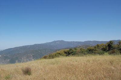
The peak!
Yea, yea it doesn't look like much but considering how wiped out I felt after only going 2.6 miles to this point, this was a big victory for me today. Plus this peak gives you really great views of the surrounding mountains.
My infirmities aside, this is a great little trail, as long as you are up to the challenge. If you are only looking to get out for a few hours in the LA then head out the 210 to this sucka!
Subscribe to:
Post Comments (Atom)


0 comments:
Post a Comment