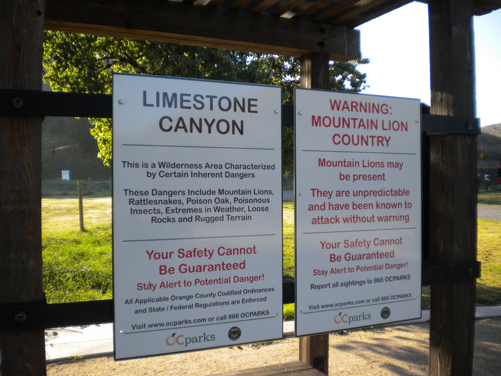
For my first hike in 2012, I decided to explore Limestone Canyon. As part of the Irvine Ranch system, the canyon area is privately held and very restricted to the public. Generally if you want to hike on this land, it has to be by guides from the Irvine Ranch Conservancy at set times. What made this hike so interesting was that it was unrestricted, you could go where you wanted, within certain guidelines.
Those guidelines were laid down with the authority of Moses on the IRC website. Go off trail? Not only is that a paddlin' but a fine. If you went off trail, not only would your wallet be lighter but there were all types of poisonous things and mountain lions. In fact, when I pulled up to the jumping parking lot

just before 9am (you could only hike 9-3) I was handed this map of the trails I could go on.

While only 138 slots were available to hike around the canyon, the lack of diversity on the trails meant that you had more than a few people around you at most times on the popular trails.
I didn't know what to expect because there is a paucity of trip reports and maps on the web. Several of the maps I did find said "beware" trails have been changed around. I decided to follow the restrictive map and hike what turned out to be a very popular trail and started hiking on the Limestone Canyon Trail:

Of course, not everything went right on this morning as my camera decided not to work so all of the following shots were taking by my HTC Evo cell phone. I was surprised of the quality of the shots and while only a 1/3 of the pixels of a "traditional" digital camera, I am happy with how they came out.
You start off on a rather flat and wide trail

which continues to go through grasslands

and just keeps going and going.

Now I am no hiking snob but I was starting to find the straight and wide "canoe" path through the canyon valley a bit repetitive and tiresome. I have annoying habit of finding the tough way to hike a trail and doing it. After contemplating my map, I decided to add another mile plus to my trip and hike the ridgeline of the Canyon.

Boy am I glad I did. As soon as I took the ridge trail I started hiking on more interesting terrain with actual grass on the path. Grass people!

This is exciting stuff to the SoCal hiker who is used to hiking on the dirt of the fire roads or chapparal of the mountains.
As you start hiking on the ridgeline, reminders of the mountain lion community are everywhere through both paw prints in the mud and of course this nice collection of bones.

There were also several other bleached bones on this ridgeline trail and I was praying that those animals had peaceful deaths and that I was not walking on a runway into someone's kitchen.
The ridgeline gets you up out of the valley and there are several ups and downs over the 2+ miles you are on it. Another benefit was the hikers and the hordes of bikers (I had never seen so many people biking the roads around the canyon as well as in the park itself as I did this day) kept to the main canyon trail and only myself and 2 bikers were on the ridgeline trail. I like people but it was nice to have it relatively to myself.
What was weird about the ridgeline was that it was on the other side of the fence which demarcated the boundary of the park.

So you are pretty much hiking outside of everything. But the benefit of doing so is that it gets you up and when you are up in the air, the views around you are pretty awesome.


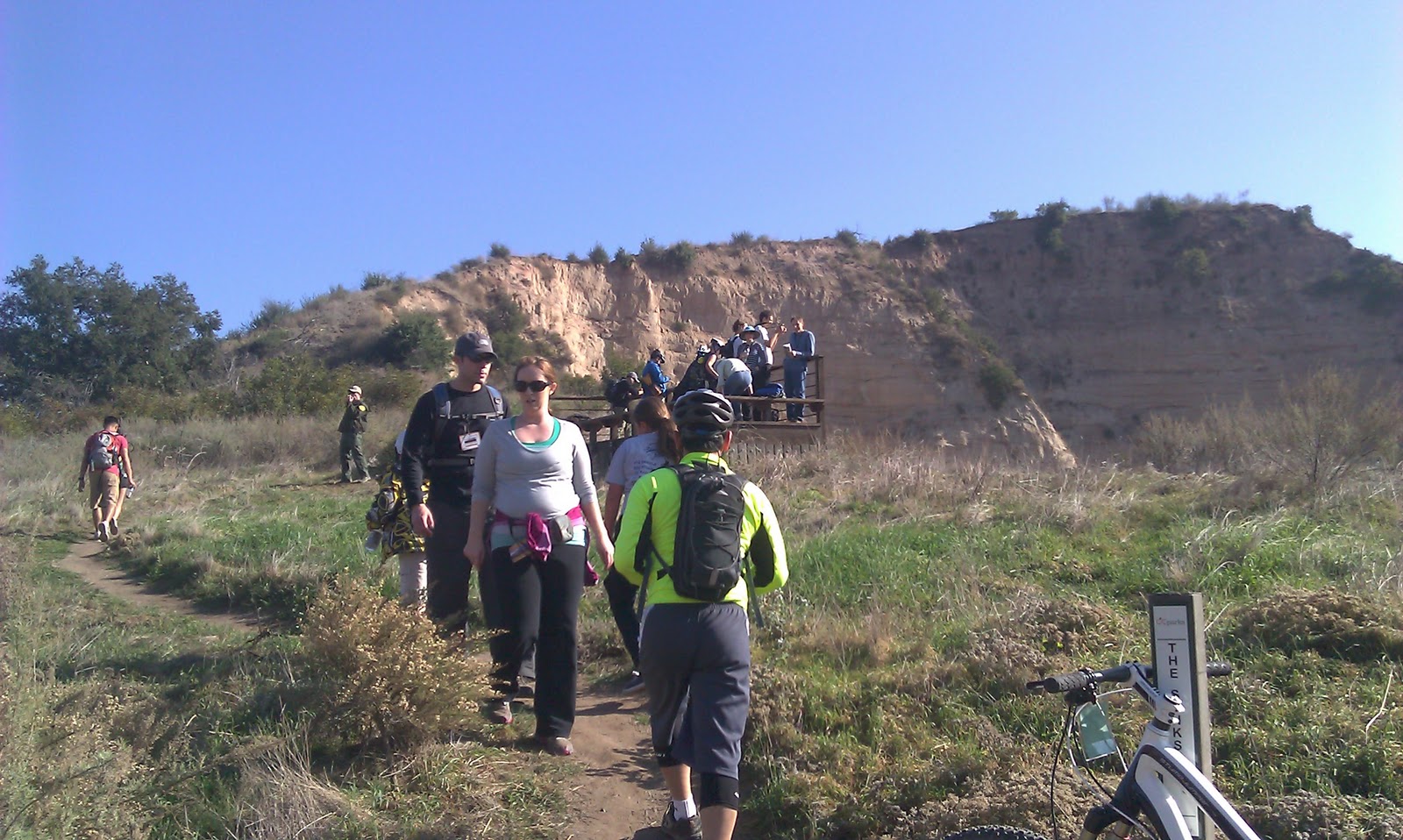
As you keep trudging along, eventually you start to see The Sinks, which is the main eye-candy attraction of the park.

To get there, you basically have to stick on the trail, there are only 2 connector trails to the other main trails from the ridgeline and given the draconian sanctions if you decided to bushwhack it down, you stick on the trail to a connector.
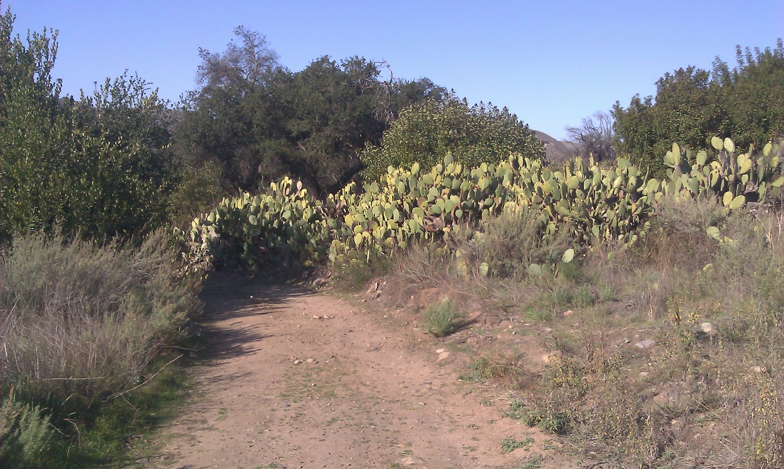
The connector trail I took was the Cactus Canyon trail which was aptly named.
Eventually you get to The Sinks and its a fascinating little place. Little because it is almost as if the Earth took a scalpel and carved out a Grand Canyon-lite out of a green hillside in California, nothing else looks like this in the park at all.


The irony of this trek was that I barely spent any time at the picturesque payoff because there were so many people at the overlook. And a few of them wouldn't shut up. They just wouldn't.
So I left and continued on the loop around the canyon. Oh ho ho, East Loma trail, I figured out your trick. Your trick is that you should only be hiked West to East because if you hike it the other way, you will keep going uphill and your calves will hurt because you ate too many gingerbread men over the holiday break. Yes East Loma trail

I am onto you.
A side benefit of hiking this trail (which goes for about 3+ miles) was that I met this great older gentlemen and we gabbed about trails all over SoCal which made the trail bounce along. Other than gabbing, this trail goes up and down swale grass'd hills with nice but hazy views of suburban OC

but there weren't many people on this trail as it didn't lead to some picturesque canyon where you could discuss whether you should get a new refrigerator or not. I was happy for that fact.
You could continue to do another loop of about 3+ miles but I was getting to the limit of my stamina at that point. I decided to take a "haul road" back to the parking lot and that was as exciting as it sounds.

Overall I did just over 9 miles and while they weren't hard miles, there are several sections that made me huff and I highly recommend leaving the Limestone Canyon path for other jaunts around the park. This is definitely a must do on the SoCal'er list if for no other reason then the area is so restricted that when they open it up, you should go.
You want a map? Here is a map, its not exactly straightforward when you are there: http://www.hike-oc.com/limestone_canyon.html
Overall, glad I hike Limestone!


0 comments:
Post a Comment