
I used to hate the term "Weekend Warrior", until I became one. The sad fact is that the workweek takes a lot of my time and then I am left with trying to get my outdoors on during the weekends. So what I have been trying to do recently is when I get out and about, I am not hiking for 10+ mile stretches but I am trying to do harder routes.
When I read on Modern Hiker about a great route that clocked in around 7ish miles and really gives you a good workout, I was down. Last Sunday I rolled to Placerita Canyon in the Antelope Valley.
The Antelope Valley is quickly becoming one of my favorite places to hike. After having hiked around Devil's Punchbowl and the Devil's Chair I keep finding new and fun places to hike off of Route 14.
So, there I was in Placerita Canyon at daybreak

and there are several ways to explore the Canyon but I chose the hardest route. I decided to go on the Mazanita Trail which then hooks up with a firebreak trail before further meeting up with the Whitney Canyon Road. However, to get to Whitney Canyon, you have to go on those firebreaks which will test your calves and has been the greatest mental test I have faced on the trail in awhile.
The Manzanita Trail winds it way up from the Visitor's Center and gets you sweating pretty decently.


However, this is only a warmup for the true test to come. There is a little side peak for Manzanita "Mountain" off to the right which offers some good views

but uses up precious energy getting to the top. You will need all you can muster for the firebreaks.

This is the third firebreak hill.

The thing about these hills is that they severely up-slope and then maddeningly will go down for awhile until you have to do it all over again. I have been averaging about 22 minutes a mile over the last few hikes. This section I was averaging about 36 minutes a mile. Why that disparity?
In addition to sucking wind and leaning on my sticks, it really was about psyching yourself up to go up yet another hill. I would stand at the bottom of yet another firebreak hill and think "ok, I can do this, I have to do this" and then start up another hill. Of course, I was the only psycho going this way so it was just me and my thoughts.

It was a good test of your willingness to put yourself through another hill. I was also fortunate to start so early, the sun stayed below the higher canyons but I can imagine if you do this hike during midday, you will turn into a puddle. Only do this sucka morning or later in the day.
After awhile, the psyching up was taking too long so I started just going up the hills with my eyes checking out what my feet were doing. I actually started making better time. Modern Hiker stated that once you make it to the Whitney junction, "pat yourself on the back". I raised by poles in in a little whirly bird triumph and then sat in the shade for a awhile.

(from this view, you know your close to Whitney)
Eventually after you collect yourself, you hang a left and start walking to a further trail junction. There are several other trails that head right but I did not explore them. One might lead its way up to a radio tower for higher views of the surrounding area but I could care less as I wanted no further part of going uphill on this one.
You then make your way to a picnic area (with this random pen being an example of our "fees at work")


and once you see this sign

you can start heading down the trail in a loop back. The landscape changes dramatically


with lots of oaks etc. However, the first mile I was basically sprinting because flies decided that Sunday was mating season. I grew up in the East where many people use bandanas to keep sweat away from the eyes as well as the sun off you. Hiking around in Cali, I have had to up my game of sun protection. I recently got a desert scarf which came in really handy once I wrapped it around my face to keep those horny bugs away.

Too bad I couldn't shoot em

Eventually you keep going downhill (blessedly downhill) and come out of the trees as the trail hugs the side of the mountains.

There are some pretty impressive views along the way.


And apples?

Eventually the trail evens out and it s a 2 mile trek back to the Visitor's Center. It is flat (big bonus) and actually takes you through the "canyon" portion of Placerita Canyon.


At the end of the trail there is a very cool Visitor's Center with a huge hawk that was eying me up for dinna.

Also, do the park a favor, put a few dollars in the Visitor Center to contribute to the upkeep of Hawky and the other animals they have there.
Overall, at 8 miles, if you went the way I did, this hike will challenge your very soul. Bwahhahahaha. So if you are looking for not just a physical challenge but a mental one, check it out. I am glad I did it and came out the other side.
The most invaluable trip report comes, of course, from Modern Hiker here: http://www.modernhiker.com/2011/06/27/hiking-placerita-canyon-firebreak-trail/
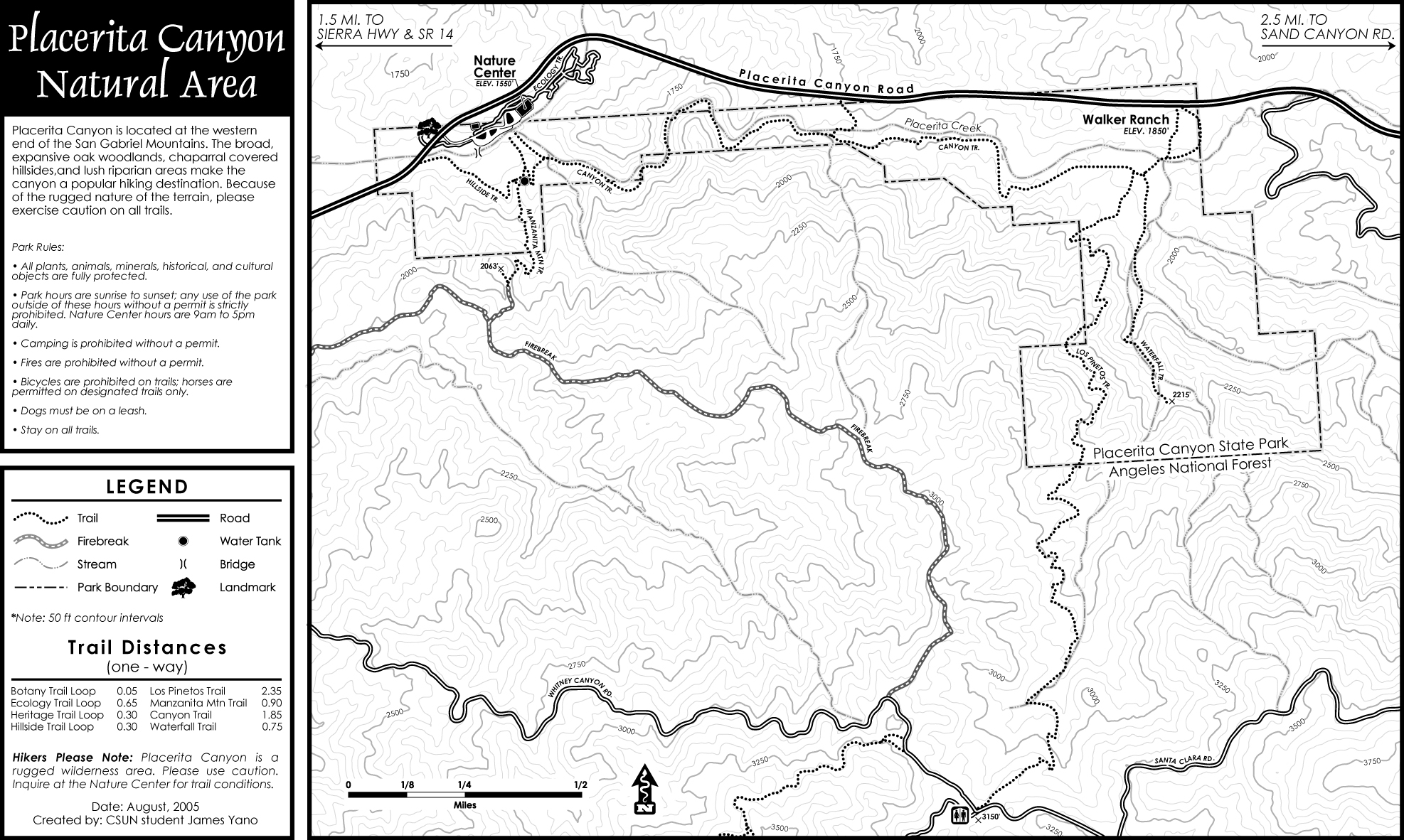
This map also gives you a great sense of the various trails you can do here. http://www.placerita.org/_img/placerita_canyon_trail_map_pg1.jpg
HIGHLY recommend (in the cool seasons).


Glad to see SOMEONE is finally addressing the issue of horny flies.
ReplyDeleteVery cool report. I love the variation of the trail. If you keep doing trails like these, those hills will be no problem.
ReplyDeleteWe have a name for that trail and it's NOT G rated. Just when you think you couldn't possibly be climbing any higher or steeper you come to find out how very, very wrong you are.
ReplyDelete